Found 4 results tagged with 'land'

  Filter results using tags

Click tags to include or exclude from results

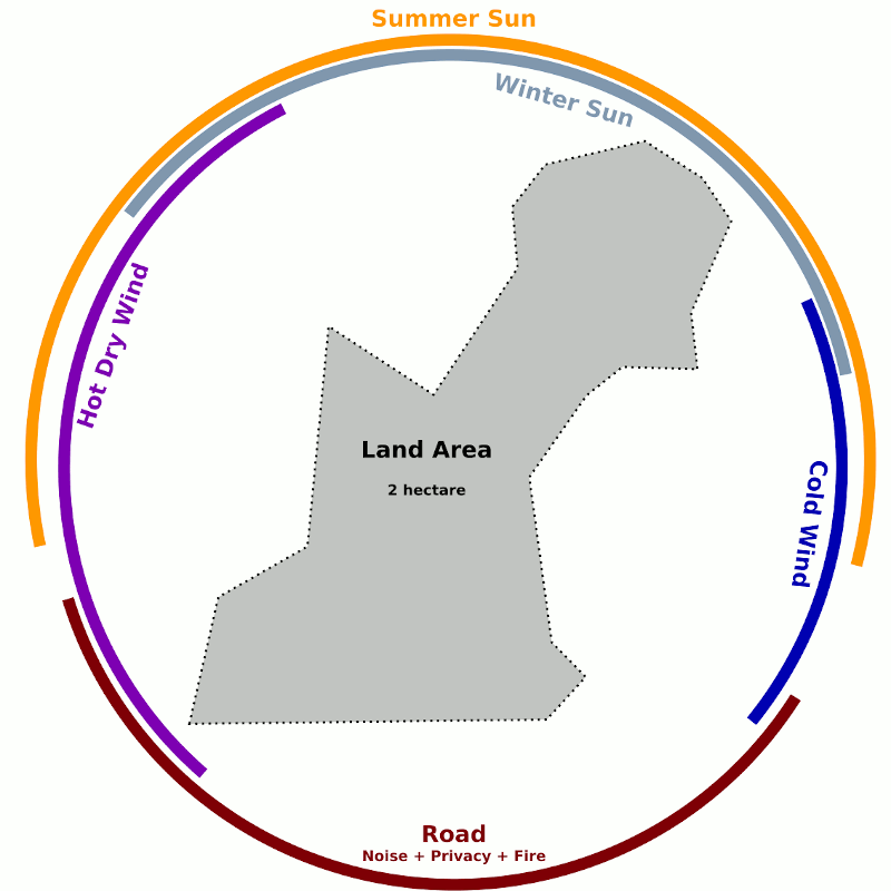
Sector analysis for optimal land use

Sector analysis for optimal land use

One of the fundamental aspects to designing a sensible landscape for habitation and production is the consideration of the various external energies, forces and factors that can impact the site. These commonly include sunlight, wind, visibility, water flow, wildfire and wildlife.

Mapping the 'sectors' where these threats or energies originate you can help determine the placement of elements (plantings, buildings, earthworks) that benefit from or lessen the impact of these forces.

Most of these sectors are easy to identify with on the ground observation or inspection of detailed maps while seasonal sun angles are available for a known latitude.

Local conditions such as hills, valleys and large trees modify wind directions and intensity, cast shade and impact fire rick and behavior. These site specific characteristics may be evident to a well trained eye or can be learnt over an extended period of time spent on site or in discussion with previous occupants or neighbors.

Exclusion / Restrict flow
Generally it is desirable to exclude strong winds by planting fast growing shelter trees suitable for the site and of appropriate heights. This may be combines with fire 'proofing' by selecting naturally lass flammable species.
Roads and other thoroughfares are a source of noise, possible pollution and fire risk and the curious eyes of passers. For privacy and security reasons it may be advisable this with planting or construction.

Inclusion / Aid flow
Sunlight (solar energy) is essential for growth and can assist in many other processes or activities such as drying fruit or washing, heating water etc.
Allowing water to enter the site is usually valuable but too much can cause issues so having suitable drainage is essential.
Cold air naturally flows down slope but can 'pool' or get trapped behind dense plantings. If frosts are a problem, considering cold air flow may help improve growing conditions.
Restoring China's Loess Plateau

Restoring China's Loess Plateau

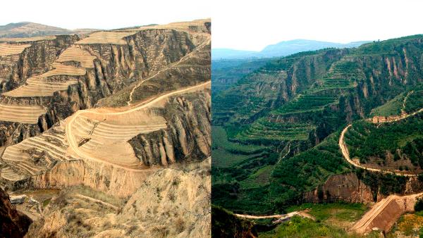
Home to more than 50 million people, the Loess Plateau in China’s Northwest takes its name from the dry powdery wind-blown soil. Centuries of overuse and overgrazing led to one of the highest erosion rates in the world and widespread poverty.

Two projects set out to restore China’s heavily degraded Loess Plateau through one of the world’s largest erosion control programs with the goal of returning this poor part of China to an area of sustainable agricultural production.
  land  water  terracing 
Water Smart Solutions: Designing Resilient Landscapes for a Drought-Resistant Future

Water Smart Solutions: Designing Resilient Landscapes for a Drought-Resistant Future

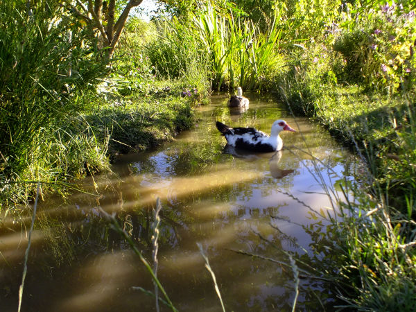
In an era where droughts are becoming increasingly common, effective land use and water smart design are essential for sustainable living. Our consultancy specializes in innovative strategies that integrate rainwater catchment systems into the very fabric of the landscape, ensuring a resilient environment that can thrive even in the harshest conditions.

By focusing on three core elements - identifying and intercepting water flows, enhancing soil moisture retention and mitigating the impact of hot, dry winds - we empower the transformation of landscapes into efficient water management systems.

Discover how simple land use patterns and strategic planting can not only preserve moisture but also enhance the ecological integrity of your environment, leading to a sustainable future where drought is not a threat but a manageable challenge.
  water  rain  land  farm  service